
Geoscapes 2017 - Calendar Image - Information
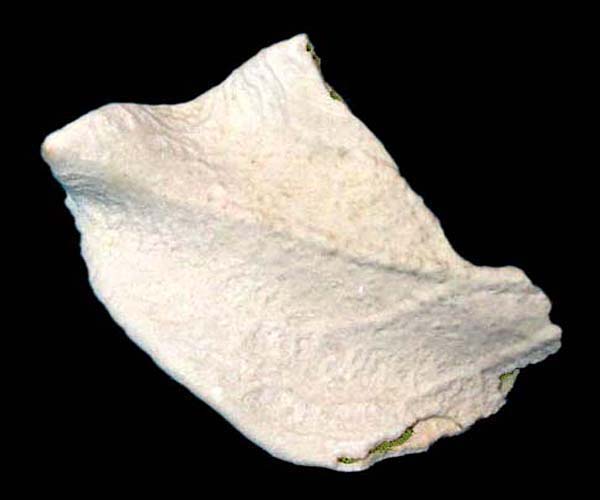
Geoscapes 2017 Cover : Granite Boulders, Ameib Farm, Namibia
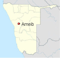
Coordinates : 21°47'2.60"S 15°39'28.23"E, Erongo, Namibia
Granite is a subvolcanic rock, typically formed by the three minerals feldspar, quartz and mica. Granite starts as a massive magma bubble, rising to form an impressive volcano eruption. But soon the power to erupt fails and the magma bubble slowly starts cooling in great depth, never reaching the surface. Well, not exactly never ! While most granite plutons indeed stay hidden in the ground, some granites are exposed by prolonged weathering through geological ages and we can see them on the surface today.
Weathering granite masses show very conspicious forms and shapes. In german language this weathering pattern is known as "Wollsackverwitterung" which literally translates to "wool sack weathering". Indeed granite landscapes often resemble large heaps of wool sacks thrown around, often forming soft and rounded, stunning landscapes.
Our Geoscapes 2017 cover photo shows one of these granite landscapes with large granite boulders, called "Bulls Party" on the Ameib farm in Western Namibia. I have visited this geosite again and again for 25 years now and feel absolutely fascinated by its geological harmony. So it is no wonder, that we use this specific granite boulder as company logo for some years now...
Uses of Granite : Granite is a hard and polishable rock, which is widely used as ornamental stone in the building industry. Despite its durability granite is subject to weathering in geological times and forms important china clay / kaolin deposits - e.g. in Bavaria and Cornwall - which are used as mineral feed for the ceramic industry. Granite is also the host rock of many important tin and tungsten deposits, see our January Geoscape below for more information.
January 2017 - Cornish Landscape with Dolmen and Tin Mine
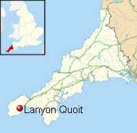
Coordinates : 50° 8'50.52"N 5°35'56.56"W, Lanyon Quoit, Penzance, Cornwall
The geological backbone of Cornwall in Southwestern Britain is formed by several large granite masses, which intruded into the continental crust many millions years ago. Prolonged weathering finally removed enough covering rock to free the granite, which is now exposed in much of Cornwall and in neigbouring Devon.
Granite often hosts economic mineralisation, which was formed from metal - bearing vents and fluids percolating within the still hot granite rocks. Copper, tungsten and especially tin are the metals, Cornwall is famous for since ancient times. Indeed Cornwall was known as "Cassiterides" and "Islands of tin" to the old greek and roman scholars and without tin from here the bronze age and further human progress would have been severely hampered. Since then tin was mined for many centuries in Cornwall and Devon and both metals still are important commodities to this very day with a brand new tungsten mine opened up near Plymouth right now. Hundreds of historic "Cornish Engine Houses" for dewatering the mines and for tin ore hoisting dot the moorish landscape of Cornwall and were spread all over the British Empire from here.
Our January Geoscape shows the Lanyon Quoit Dolmen, also known as Giant´s Table, a megalithic tomb near Penzance, which was built from huge granite boulders 5000 years ago. From here you can spot easily the Cornish Engine House of the historic Carn Galver tin mine in the distance, which was in operation during the 19th century.
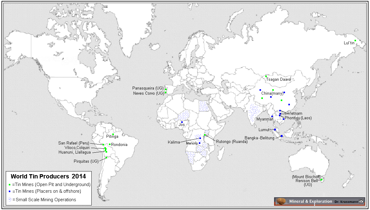
Uses of Tin : Tin is one of the oldest metals known to mankind and is an important ingredient of the copper - tin alloys called Bronze. Since 5000 years tin is a highly valued metal and nowadays the metal tin is used in a large number of alloys and other applications such as corrosion inhibitor of other metals, tin plating, solder and as an important coin metal. The annual global production of tin is aboot 300.000 tons with China and Bolivia being the most important producers. For a detailed map of global tin mines please have a look here.
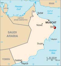
February 2017 - Ophiolites in Maskat, Sultanate of Oman
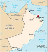
Coordinates : 23°37'20.06"N 58°34'26.25"E Matrah, Maskat, Oman
Ophiolites are typical rocks of the oceanic crust of greenish and brownish colours, which often display a strong luster. They closely resemble reptile or snake skin, so they were named "ophiolites" by the first geologists, which means "snake stone" in english. Basalt and gabbros belong to the ophiolites as well as rocks rich in the mineral olivine : peridotite, dunite and harzburgite in greater depth, see our April image for more information.
Being a part of the oceanic crust, rocks of ophiolitic origin are fairly rare on the dry land, as they are generally subducted under the continental crust at the rim of the continents, where they vanish forever. However, sometimes and for reasons still not well understood, such ophiolites are obducted, i.e. slided onto a continent, see following schematic sketch. Even rarer are such ophiolites well preserved, as is the case on the Island of Cyprus and in the Sultanate of Oman, where the Hajar mountains form a 350 kilometer long continuous ophiolite suite with excellent exposure.
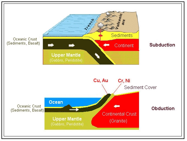
Schematic sketch of normal subduction of oceanic crust and
much rarer obduction of oceanic crust onto continental crust.
Our February 2017 Geoscape displays the rugged ophiolite coast at Matrah, part of Maskat, the capital of the Sultanate of Oman. By virtue of the dry desert climate geological exposure is excellent in almost all parts of Oman. Many geologist have come to Oman in recent years to study the ophiolites, but still many geological puzzles remain to be solved.
The Sultanate of Oman also is the historic "Land of the Frankincense" and frankincense indeed is a major export good of Oman since millenia ! In the Matrah souk just right of our image you can still see and buy frankincense, gold and myrrh, the traditional christmas gifts of the three wise kings visiting the newborn Jesus Christ. Fittingly, ruling Sultan Qaboos decided to build a giant white incense burner at the beach front to greet any visitor and foreign ship heading for the port of Maskat.
March 2017 - Echium near Volcano, Lanzarote, Canary Islands
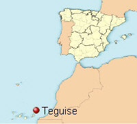
Coordinates : 29° 3'14.14"N 13°37'56.11"W Teguise, Lanzarote
Virtually no visitor will leave Lanzarote island of the Canaries without visiting the "Fire Mountains" of the Timanfaya National Park. Here in September 1730 one of the longest and most severe volcanic eruption cycles known begun without any prior warning, which ended only after 6 long and hard years of steady eruptions and devastation. Here is a quote from the onset of these events, cited from the famous report of the priest of Yaiza village :
"On September, 1th between 9 pm and 10 pm in the evening the earth ruptured suddenly close to Timanfaya two miles from Yaiza. In the first night a giant mountain rose from the womb of the earth, sending out flames which burned without end for nineteen days..."
The Timanfaya fires are unmatched in their duration on the European continent in historic times but in Iceland, where the "Myvatn Fires" lasted from 1725 - 1729 - i.e. just before the Lanzarote eruptions - comprising a similar long continuous volcanic activity. The Timanfaya eruptions devastated an area of 200 square kilometers of formerly arable land wirh several villages, which now are buried by thick layers of lavas and ashes. The lava streams flowed to the northwest and west, sometimes forming spectacular red hot lava falls into the boiling ocean. A part of the lava flows however went to the north and reached the island capital Arrecife. Here the lava formed typical smooth pahoehoe lava fields, which are accessible in many places such as at Tahiche, see next image.
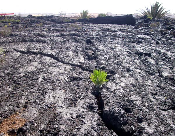
Smooth pahoehoe lava near Tahiche, Lanzarote island
Our March 2017 geoscape shows one of the endemic plants of the Canary Islands : The Giant Echium in full flower with a volcan cone of the 1730 - 1736 Timanfaya eruptions in the background. The photo was taken near the town of Teguise. More information on the geology, volcanism and mineralogy of Lanzarote can be found in our online publication "Geologische Streifzüge auf Lanzarote und Graciosa" which you can read and download here.
April 2017 - Olivine Sand on chalky Limestone,
Governor´s Beach, Southern Cyprus
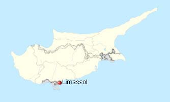
Coordinates : 34°42'28.53"N 33°16'2.77"E, East of Limassol, Cyprus
The island of Aphrodite - a commonly used nickname of Cyprus - hosts the Troodos mountains, which are one of the best studied ophiolite massifs of the world. During weathering ophiolites may produce large quantities of olivine sand, one of the common minerals found in these rocks. Sometimes the olivine accumulates in beach sands and form "black beaches" e.g. at Governor´s Beach five kilometer east of Limassol in Southern Cyprus.
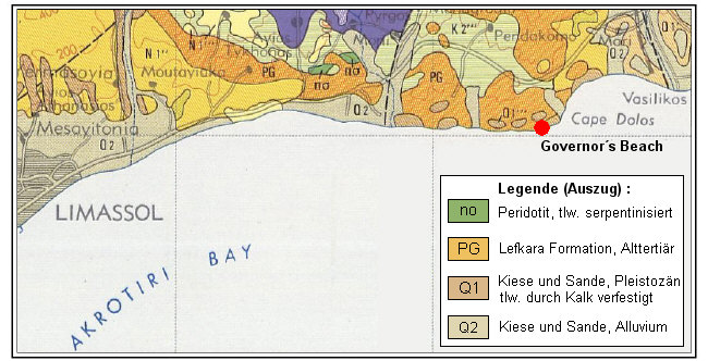
Geology of the Governor`s Beach area, Southern Cyprus
redrawn from the Geological Map of Cyprus, 1979
Our April 2017 Geoscape shows black (actually : dark green) olivine sands with nicely contrasting white tertiary chalky limestone. The olivine derives from small peridotite outcrops about two kilometers from the beach, see green areas (no) shown in the geological map above.
Fresh green Olivine in an earth mantle xenolite
Uses of Olivine : Rocks rich in Olivine - also known as dunites - are important industrial minerals, which are primarily used for refractories, as foundry sand and as magnesium rich additive in the steel making process. Olivine easily weathers to the more common mineral serpentine and in the process of doing so, may be able to adsorb great quantities of carbon dioxide. Hence a lot of research is currently conducted on the potential to use olivine / dunite rocks for CO2 sequestration and fixation.
May 2017 - Adonis on Gypsum Rock, Middle Franconia, Germany

Coordinates : 49°31'29.67"N 10°24'53.73"E, Külsheimer Gipshügel, Bad Windsheim,
Middle Franconia, Bavaria, Germany
Gypsum is a mineral which can be found in everydays life in many applications, hence gypsum is well known to many people. However few people know that gypsum is mined large scale in many countries both in open pits and in underground mines, e.g. in Germany, Spain, France, Italy and the UK. Gypsum was formed from the evaporation of sea water, leaving often thick gypsum beds as residue and occurs in various geological ages such as the Upper Permian (Zechstein) and in the Mesozoic. Gypsum rock is fairly water soluble and hence will form gypsum karst with sinkholes and caves at the surface harbouring rare plants and animals. Our May image shows the Spring Adonis (Adonis vernalis) which is one of the rare and protected plants thrieving on gypsiferous soils with the Pasque flower pictured below being another one.
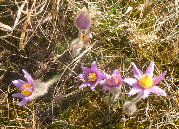
Flowering Pasqueflower / Pulsatilla, Külsheimer Gipshügel, Northern Bavaria
There is often a conflict between the need of mining and quarrying gypsum as an important industrial mineral and the need for protecting parts of the gypsum karst areas as nature reserves and biotopes. A conflict, which can only be solved by open discussion, tolerance and mutual understanding between the gypsum industry and environmentalists.
Uses of Gypsum : Gypsum is a unqiue mineral thanks to its ability to release water reversibly during heating. So gypsum is ideally suited for use in the construction and building industry as well as stucco and plaster of Paris for decorating purposes. While gypsum from flue-gas desulfurization can substitute natural gypsum - at least partly - in the building industry, highter qualities needs to be produced from natural gypsum rock. The cement industry is using gypsum and closely related anhydrite in high quantities as sulfate binder, while high purity gypsum is used for medical and dental uses and in the form of translucent alabaster for sculptural artistry.
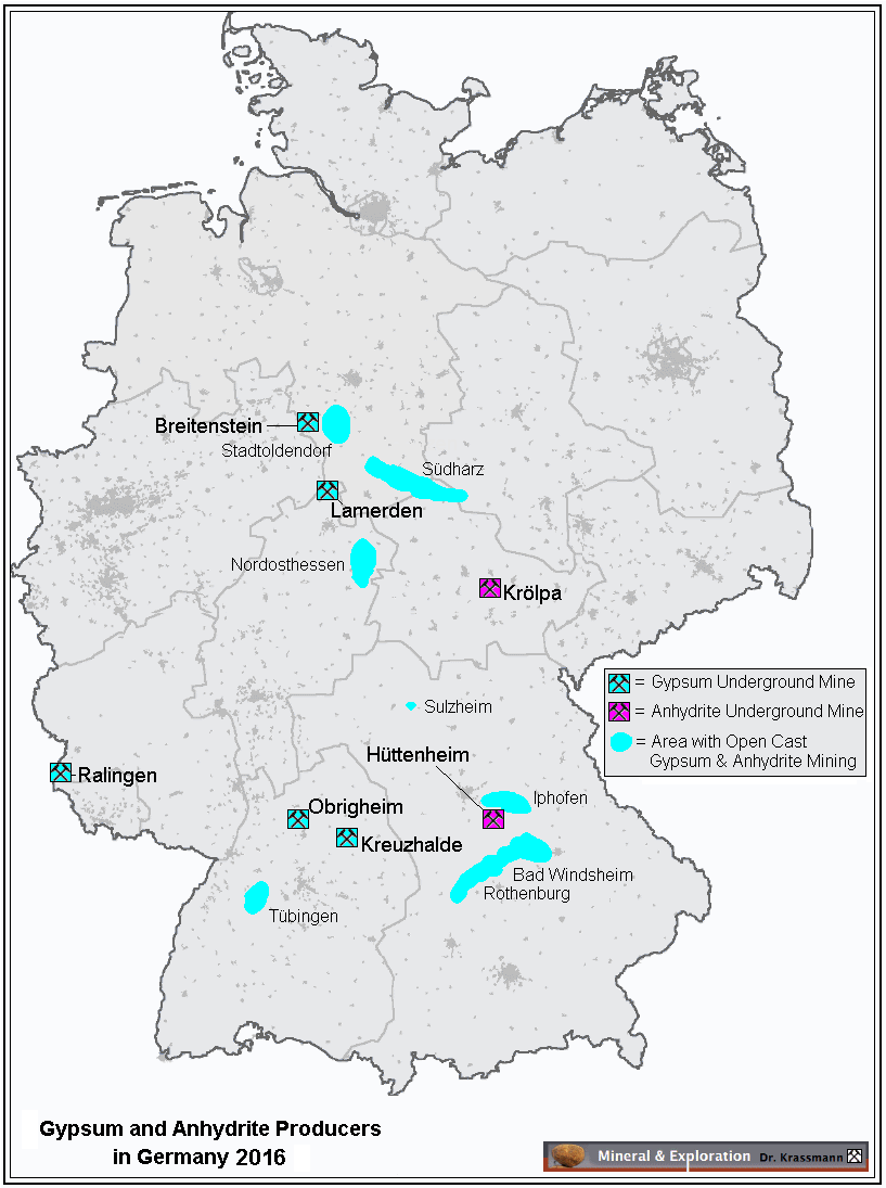
For a detailed map of gypsum and anhydrite producers in Germany please click here.
June 2017 - Summer Evening with Glacial Erratics, Rutja, Estonia
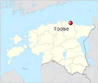
Coordinates : 59°33'3.06"N 26°22'27.77"E, Rutja, Toolse, Estonia
Land rises from the Sea !
Northern Europe is a land formed by glaciation. Climate was changing constantly from bitter frost to interglacial warmth; kilometer high glaciers pushed far to the south and retreated again and again, the last time 10.000 years ago. They left many and diverse traces : long glacier moraines and smoothly rounded rocks and boulders, sometimes deeply scratched or nicely polished. Or the very common glacial erratics : rounded rock boulders transported from far and diverse provenance by the wandering ice masses and left behind after the great thaw.
During the great thaw the global oceans rose by an estimated 100 meter and flooded many deep lying coastal areas. Britain became an island (again) and so did Australia; America became separated from the Siberian landmass. However, some countries started to rise, freed from the enormous weight and pressure of the ice masses covering those areas before. Since then Scandinavia rises again with - geologically speaking - remarkable speed of 1 - 2 cm per year and will doing so for the foreseeable future. Even the neighbouring Baltic countries are rising from the Baltic Sea, though at a much slower speed.
Our June 2017 Geoscape shows land rising from the sea, here at the Estonian coast, where the rising speed is just 1 - 2 millimeter per year. Glacial erratics slowly grow from the shallow sea along the coastline, year after year a millimeter or two, forming an unique landscape of great harmony and calmness.
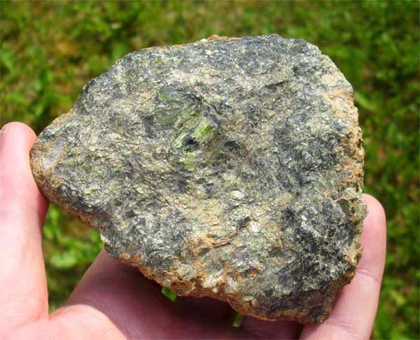
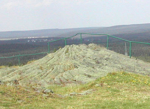
July 2017 - Hirtstein Basalt near Satzung, Erzgebirge, Saxony
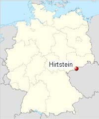
Coordinates : 50°32'11.10"N 13°11'36.09"E Satzung, Upper Erzgebirge, Saxony, Germany
Basalt is a common silica poor volcanic rock of distinct dark colour, which often forms characteristic long columns. Similar to mud cracks, a more or less hexagonal crack pattern will form on the surface of the slowly cooling basalt stream. With ongoing cooling, the cracks will deepen into the lava, separating each basalt column from its five or six neighbours. By cooling from different sides more complex column patterns may form, such as the fine basalt "palm leaf" exposed at the Hirtstein quarry featured in our July 2017 geoscape image.
The orientation of basalt columns is complex indeed and may change over short distance. Just above the beautiful "palm leaf" of Hirtstein quarry the basalt columns show a completely different orientation, as can be seen in the following image and in the schematic sketch given below.
Basalt column orientation just above the Hirtstein "palm leaf"
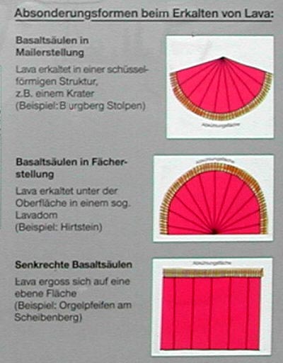
Geological information table at the Hirtstein with
explanation of different geometries of basalt columns
Uses of Basalt : Basalt is a hard and weathering resistant rock, which is quarried in large quantities for use as aggregate in road- and railway building as well as in the building industry. It is also used as black gravel in garden architecture and is valued as fine milled powder as mineral fertilizer. A more modern application is basalt wool, which serves as excellent thermal insulator.
August 2017 - At the Grosse Spitzkoppe, Namibia
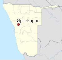
Coordinates : 21°50'46.35"S 15°10'57.42"E, Spitzkoppe, Namibia
Granite is a subvolcanic rock, typically formed by three distinct minerals : feldspar, quartz and mica. Granite starts as a massive magma bubble, rising to form an impressive volcano eruption. But soon the power to erupt fails and the magma bubble slowly starts cooling in great depth, never reaching the surface of the earth. Well, not exactly never ! While most granite plutons stay hidden in the ground, some granites are exposed by prolonged weathering and we can see them on surface today.
In the process of surface weathering granite masses show very conspicious forms and shapes. In german language this weathering pattern is known as "Wollsackverwitterung" which translates to "wool sack weathering". Indeed granite landscapes often resemble large heaps of wool sacks thrown around, often forming soft and rounded, stunning landscapes.
The Geoscapes August 2017 shows one of these granite landscapes with gently rounded granite masses, which nonetheless can form impressive summits like the "Great Sptzkoppe" in the background, which is also known as "Matterhorn of Namibia". But even shapes apparently defying gravity are common in granite rocks, such as the natural bridge in the foreground or large hanging granite roofs in the near vicinity.
Uses of Granite : Granite is a hard and polishable rock, which is widely used as ornamental stone in the building industry. However, granite is subject to weathering in geological times and form important china clay / kaolin deposits - e.g. in Bavaria and Cornwall - which are used as mineral feed for the ceramic industry. Granite is also the host rock of many important tin and tungsten deposits, see our January geoscape for more information.
September 2017 - Historic Salt Mine in Turda, Romania
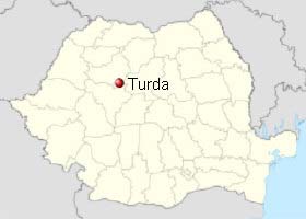
Coordinates : 46°35'15.71"N 23°47'13.90"E, Salina Turda, Western Romania
Ferry Wheel in a Salt Mine
Large salt deposits of Miocene age are known to occur just a few meters underground in Western Romania with surface rock salt exposures in several places. The salt deposit at Turda is known since ancient times and the Romans built Potaissa here, one of their largest towns in Dacia (=Romania), for controlling the mining of salt in this area. Salt extracttion continued unabated for the next 1300 years. Since 1690, when Romania became part of the Austrian Empire, the salt mines of Turda where thoroughly modernized and three new large mines - actually large bell shaped salt extraction chambers known as Theresia, Anton and Joseph were constructed with a 900 meter long interconnecting adit to faciliate salt block extraction and raising to the surface.
After modernization the Turda salt mines flourished for some decades, but over the time got strong competition of the nearby Ocna Mures saltworks. Attempts to introduce modern blasting methods in Turda failed and finally the Turda salt mines with its well preserved underground chambers were abandoned in 1932.
Recently the Turda salt mine was converted into a truly outstanding and unique geotourism attraction, combining the geology and history of a 19th century salt mine with the modern facilities of an underground fun park including a salt lake with boats, underground pool, concert stage, mini golf and even an underground ferry wheel !
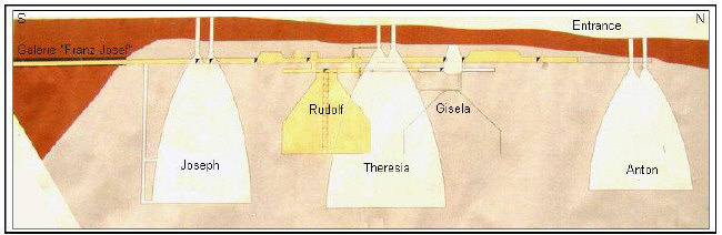
Plan of the historic salt mine chambers in Salina Turda
More information on the Turda salt mine can be found in our online publication : "Geotourim : The Turda Salt Mine in Romania", which can be accessed here.
October 2017 - Laacher See Volcanism, Eppelsberg, Eifel
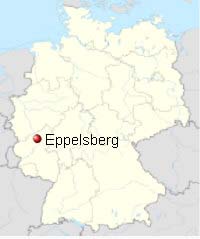
Coordinates : 50°24'3.55"N 7°19'13.20"E, Nickenich, Laacher See, Eifel, Western Germany
Lava is not the only eruption product of a volcano. Indeed the total quantity of gases emitted by a volcano such as sulphur dioxide and carbon dioxide is often much higher than the lava produced. Also the total volume of tephra = lapilli, pumice and volcanic ash - produced by a single volcanic blast and distributed in the vicinity can be enormous.
A particular impressive example in Germany is the Laacher See (Lake of Laach) eruption in the Eifel mountains south of Cologne, which happened 11.000 years ago at the end of the last ice age. Virtually no lava was produced by this eruption, but an estimated mass of 16 cubic kilometers of fine pumice and ashes were ejected in just a few days! The geosite Wingertsbergwand near the small town of Mendig is a large exposure of layered pumice and ashes, documenting the eruption of the nearby Laacher See volcano, see the following image.
The ejected Laacher See pumice was "air-lifted" over enormous distances and can be found as conspicious white marker horizon in swamps and moors as far as Southern Sweden and Southern France. The eruption of the Laacher See is considered to be VEI 6 on the volcano explosivity index scale, being of about the same magnitude as the fierce Pinatubo eruption in the Philippines 1991.
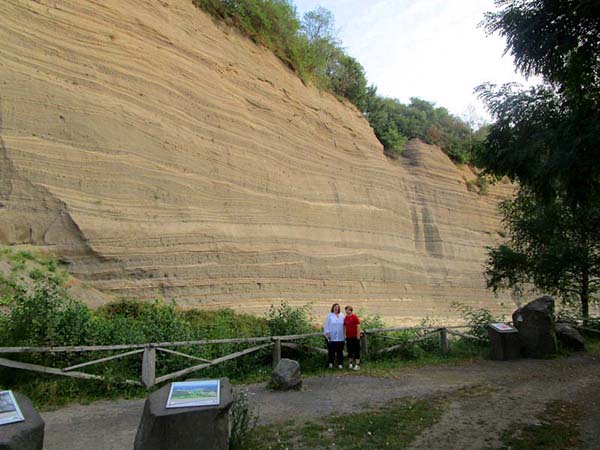
20 meter thick pumice strata at the nearby Wingertsbergwand, deposited within a few hours !
Our October 2017 geoscape shows a section of the Eppelsberg quarry about 3 kilometer east of the Laacher See. This outstanding geosite shows a several 10th of meter thick sucession of light cream coloured pumice and alternating dark volcanic ash layers, which have been beautifully exposed by active quarrying. A slightly younger dark basalt dyke, vertically transected and faulted the deposited Laacher See pumice / ash layers. We also see a marked unconformity between two distinct pumice / ash sucessions on the right and the left side, indicating a more complex eruption sequence than shown on the nearby Wingertsbergwand.
Attention : While the parking place at the Eppelsberg quarry is freely accessible with some info tables explaining the geological situation, entering the active quarry is restricted and only possible with guided tours. Please enquire at www.vulkanpark.com
Uses of pumice : Already the Romans used and valued the Eifel pumice and indeed developed one of the largest known Roman underground mines here, parts of which can be visited in the highly recommendable "Römerbergwerk Meurin" (roman mine Meurin) in Kretz. Pumice and pumice rock are nowadays quarried on a large scale in the Laacher See area and are used extensively as light weight aggregate in the building industry. Pumice is also used as mild abrasive, especially in the pharmaceutic and beauty industry.
November 2017 - Ancient Tomb in Travertine, Pamukkale, Turkey
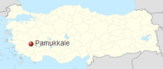
Coordinates : ~ 37°55'28.77"N 29° 7'19.97"E, Denizli, Turkey
Our November 2017 geoscape shows Pamukkale, literally translated "cotton castle", which is a large active calcium carbonate travertine deposit forming a myriad of cascading sinter terraces close to Denizli in Western Turkey. Since antiquity the place is famous for its hot and soothing waters and many wealthy Greek and Romans came here to live to their earthly end and laid to rest in beautiful tombs. The ancient town of Hierapolis once flourished here inmidth of the white travertine terraces and despite several devastating earthquakes continued to flourish into the 7th century AD.
The Pamukkale springs have a year round temperature of 36 °C Celsius and carry about half a gram of calcium carbonate per liter, which starts to release fresh travertine in no time. Indeed the fastness of calcite formation is remarkable and green leaves are enclosed by thick travertine in just a few days, see image below.
Fresh travertine sinter on still green leaf, formed within just a few days !
Our November 2017 geoscape features white travertine sinter covering parts of the ancient necropolis - i.e. cemetery - of Hierapolis and indeed many exciting archaeological finds have been unearthed from below the travertines. The sinter terraces of Pamukkale have been included into the World Heritage List 1988 due to their (almost) unique geology and historical importance as well as their outstanding beauty.